Point Cloud
Surveys
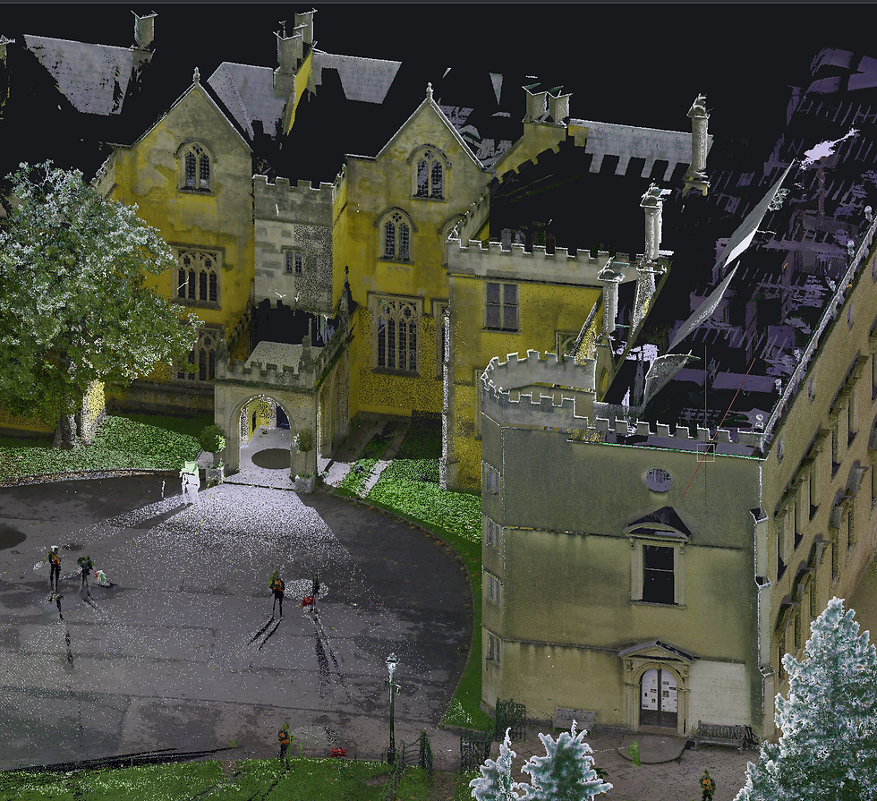
Point Cloud Surveys capture highly detailed 3D representations of buildings, structures, and sites, providing precise spatial data for design, refurbishment, and construction projects. Using advanced 3D laser scanning technology, point clouds allow for accurate measurement, modelling, and visualisation of complex environments.
About This Service
Millions of precise points.
One accurate 3D model
At Lansdowne Surveys Ltd, we utilise cutting-edge equipment, including the Leica RTC360, to create dense, accurate point clouds that form the foundation for informed decision-making.
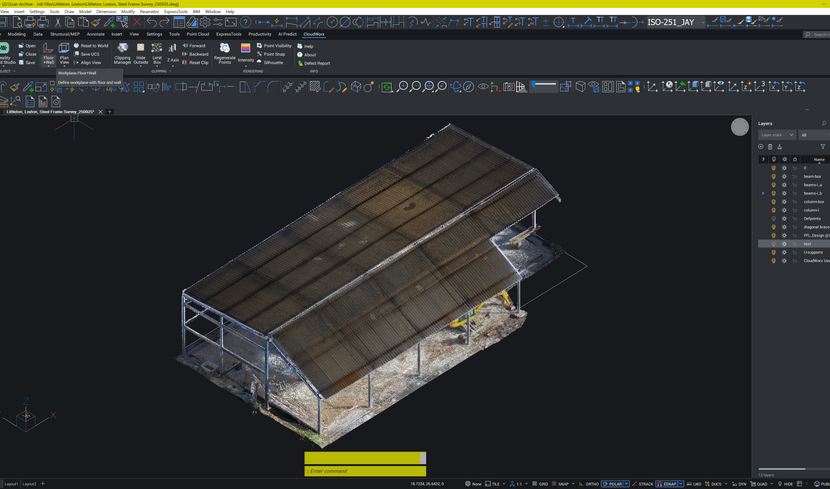
Point cloud surveys offer exceptional accuracy, capturing millions of precise points to represent every detail of a site. They are ideal for refurbishment, extensions, or heritage buildings where traditional surveying is challenging. Point cloud data integrates seamlessly into BIM and CAD workflows for architects, engineers, and contractors, and allows for clash detection, volumetric calculations, and precise measurements in 3D.
Point Cloud Surveys offer a modern, highly accurate method to capture and document the built environment, helping clients make confident, data-driven decisions throughout the project lifecycle.
Deliverables
Registered Point Cloud (E57 / RCP)
2D CAD Drawings (DWG)
3D BIM Model (RVT / IFC)
Clash Detection Reports
Volumetric Calculations
PDF Plots at Specified Scale
Interested in a point cloud survey for your project? Get in touch and we will provide a competitive, no-obligation quote.


Gallery