
Drone Surveys // As-Built // Surveys // Measured Building Surveys // Volume Calculations // Cut & Fill Analysis // Sections & Elevations // Topographical Surveys // Point Cloud Scanning // Site Setting Out //
Topographical Surveys
Detailed and accurate mapping of land and features, forming the foundation of successful planning, design, and construction projects.
As-Built Surveys
Precise documentation of completed construction works, verifying builds match design specifications for sign-off and future reference.
Site Setting Out
On-site engineering support transferring design coordinates to the ground with total station precision, keeping construction on spec and on programme.
Point Cloud Surveys
High-density 3D laser scanning for complex architectural detail. Seamlessly integrates with Revit and BIM workflows, streamlining sections, elevations and floorplans.
Drone Surveys
UAV aerial surveys for large sites, difficult terrain and volumetric analysis. Faster and more cost-effective than traditional methods for the right applications.
Measured Building Surveys
Detailed internal and external surveys of existing structures, producing accurate floor plans, elevations and sections for renovation or design use.
Volume Calculations
Earthworks volume analysis from survey data, providing accurate cut and fill quantities to support tendering, planning and contractor cost control.
What We Do
Survey&
Engineering
nine specialist services
From initial topographical surveys through to complex point cloud scanning and drone surveys, we provide the full range of site engineering solutions for developers, contractors and architects across England. All data delivered to your required format and specification.
Company Profile
Lansdowne Surveys Ltd — Founded 1984
England-Based // National Coverage

1984
Founded
About the Company
Specialist
Survey & Engineering
in practice since 1984
Founded in 1984, Lansdowne Surveys Ltd was established with one clear objective: to provide topographical surveys and setting-out services to the highest possible standard. More than four decades later, that commitment remains at the heart of everything we do.
Founded by Mike Lansdowne, the company has built a strong reputation for accuracy, reliability, and professionalism across a wide range of surveying projects. Today, the business is led by Steve Lansdowne, continuing the high standards and customer-focused approach that have defined Lansdowne Surveys since its inception.
Our experienced team combines decades of industry expertise with the latest surveying technology. We operate advanced Leica Total Stations, GPS systems, Leica RTC360 laser scanning equipment, and DJI Matrice 4E drone technology, alongside networked CAD software, enabling us to deliver precise, efficient, and dependable survey data for projects of all sizes.
01
Get in Touch
Tell us about your site and project requirements. We'll respond promptly with the right questions to scope your survey accurately.
02
We Quote
A clear, competitive quote based on site size, scope and deliverable format. No hidden costs and no guesswork.
03
We Survey
Our team attends site with the correct equipment for the job, working efficiently to minimise disruption while maintaining full accuracy.
04
Data Delivered
Survey data is processed and delivered in your specified format - DWG, DXF, PDF or point cloud - ready to use in your workflows.
How It Works
From enquiry
to delivery
four clear steps
A straightforward process designed to get the right data to you, in the right format, on time. No ambiguity, no unnecessary complexity.

Recent Work
Our Projects
eight featured schemes

.avif)


From £24m commercial refurbishments to large-scale energy infrastructure — Lansdowne Surveys has delivered precision survey and engineering services on some of the UK's most technically demanding projects.
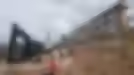
// Featured Project — Bristol
Temple Quarter
Enterprise Campus
University of Bristol
Setting out of multiple feature staircases, hundreds of structural steel goalposts, complex rooftop steelwork, and hundreds of metres of balustrades across this major new academic campus development for the University of Bristol.
Bristol
Location
4
Contractors
Education
Sector

Our Clients
Trusted by leading
contractors
national & regional
Request
a quote
we respond fast
Whether you need a topographical survey, point cloud scan or site engineering support, get in touch and we'll respond quickly with a competitive quote.
Phone
Lansdowne Surveys
Based
England — Nationwide Coverage
// Enquiry Form